The category 5 storm was about 120 kilometres north-north-west of Port Hedland and 210 kilometres north-east of Karratha overnight, and set to cross the coastline this afternoon or evening.
The slow-moving system has been gathering intensity over water, with the Bureau of Meteorology reporting possible wind gusts of 160km/h between De Grey to Roebourne, including Port Hedland.
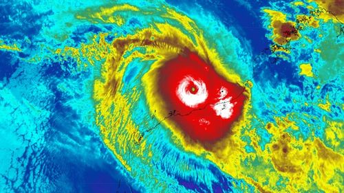
Zelia could bring up to 500 millimetres of rainfall and lead to flash flooding, posing a “threat to lives and homes”, the bureau said.
A cyclone emergency warning was in place for Pardoo Roadhouse to Whim Creek and inland to west of Marble Bar, with residents being told to shelter indoors.
Those west of Whim Creek to Karratha and Dampier, inland to Tom Price and north to Eighty Mile Beach were being told to prepare to shelter indoors.
Two evacuation centres – one in South Hedland and one in Karratha – were filling quickly last night.
Trees have already been uprooted and roads have turned to rivers as the weather ahead of the system packs a punch.
Department of Fire and Emergency Services (DFES) Commissioner Darren Klemm said Zelia was expected to trigger dangerous flash flooding across impacted regions including Karratha, Port Hedland and Dampier.
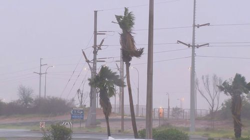
“There is a significant threat to lives and property and I urge people to follow the directions of emergency services,” he said.
A dangerous storm surge is also expected to hit when Zelia makes landfall, persisting into tomorrow.
Major retail shops and 12 schools have been shut, along with regional airports.
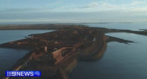
Australia’s iron ore hub is also at risk of a direct hit from the cyclone with Rio Tinto and BHP pausing operations and Fortescue suspending non-essential travel.
Several roads were closed in preparation for flooding.
“Impacts to secondary and unsealed roads are expected, which will result in some communities being isolated,” Klemm said.
“DFES will undertake resupply missions after the cyclone makes landfall.”
Klemm said DFES has secured aircraft and extra flood boats in preparation for emergency evacuations.
There are 50 mobilised incident management teams in place to prepare for Zelia.
The S61 helicopter from the national fleet is expected to arrive from NSW on Saturday and there are seven aircraft also on standby – three in Broome and two in both Karratha and Newman.
Two fixed-wing aircraft and drone capabilities from WA Police and five extra flood boats arrived yesterday.
More cyclones than anywhere else in Australia
Zelia isn’t the Pilbara’s first category 5 tropical cyclone.
The area’s been hit numerous times before with the Pilbara coast battered by more cyclones than anywhere else in the country.
Its last category 5 storm was Isla in 2023, when 289km/h winds broke records. Pardoo Roadhouse copped the brunt of it.
The last category 5 storm to smash Port Hedland was George in 2007, killing two workers on an FMG mining camp.
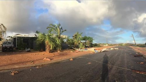
Tropical Cyclone Joan of 1975 was even more devastating, destroying 80 per cent of Hedland homes.
Exmouth was virtually flattened when Tropical Cyclone Vance came knocking in 1999, as 267km/h wind gusts pulverised the coast and destroyed more than 100 homes.
Miraculously no-one was killed during that system but in 1995 Tropical Cyclone Bobby wasn’t as forgiving.
Two fishing trawlers sank, killing seven, as Bobby roared ashore near Onslow, whilst another man drowned in floodwaters near Carnarvon.

