Here’s why, and what it means for those impacted.
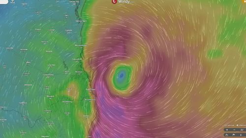
Why has Cyclone Alfred slowed down?
The cyclone’s movement has slowed due to a lack of wind in its surroundings, according to Research Fellow at Monash University’s ARC Centre for 21st Century Weather, Michael Barnes.
“It’s in a very stationary environment,” says Barnes.
“It’s just drifting slowly towards the coast on a very weak wind pushing the cyclone west.”
Does this make the cyclone more dangerous?
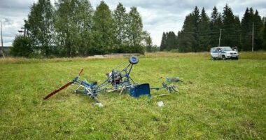
Cyclone Alfred’s crawl towards land could intensify its overall impact on infrastructure and environment by drawing out the damage.
”Typically a tropical cyclone will gain some intensity, make landfall, and kind of just whip through, which means you have 12 to 24-hour window of strong wind, strong rain, sea surge depending on the tide, and then its gone,” says Barnes.
Alfred’s slower-than-usual movement will bring the same rainfall rates, wind intensity, and surge impact of a typical tropical cyclone for a longer period of time, says Barnes.
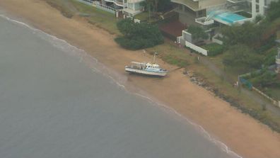
Boat washes ashore as Cyclone Alfred smashes beaches
“We’re talking about more than a 24-hour window of impact, possibly 48 or more hours, depending on the area you’re in.”
”I’m not going to say its more dangerous, but it can put things under more pressure,” says Barnes.
“Things like river flooding from high accumulated rainfall might be exacerbated.”
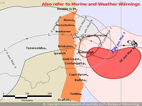
When and where is Cyclone Alfred now expect to make landfall?
Cyclone Alfred currently sits off the coast of south Queensland and northern NSW, and is forecast to cross land on Saturday morning, rather than earlier estimates of Thursday evening.
It should make landfall near the states’ border, covering an area including the Gold Coast, Brisbane, and the Sunshine Coast.
But while landfall time is important, its not the only important factor when measuring the cyclone’s impact because it’s moving slowly, says Barnes.
“After landfall, it’s still going to rain, and there’s probably still going to be wind and high seas through most of Saturday,” he adds.