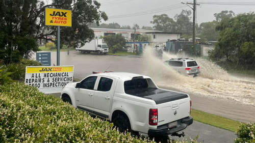
Sydney and much of Australia’s east coast have endured a month’s worth of rain in a single day, but residents in many of the impacted regions have been warned the worst of the deluge is yet to come.
More than 100mm has fallen in many areas of Sydney in the last 24 hours alone, but the falls are expected to intensify tonight and into tomorrow before easing later tomorrow and Sunday.
According to the Bureau of Meteorology (BoM), Western Sydney and the Illawarra are likely to suffer the brunt of the conditions in the coming hours.
To see the latest BoM weather warnings click here.

”The heaviest rain is likely to occur around the Illawarra escarpment and maybe inland parts of the Greater Sydney region as well, where up to 300mm is possible through the course of this entire rainfall event,” meteorologist Angus Hines said about lunchtime.
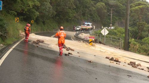
As of 5pm (AEDT), 48 warnings from the NSW SES for flooding and severe weather were in effect, ranging from Bega in the state’s south-east all the way to Willara Crossing in the north-west.
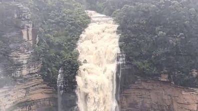
Stunning waterfall emerges out of the bush during heavy rain
The emergency service said it had already responded to more than 820 calls for help due to the weather midway through the afternoon.
People in Chipping Norton, not far from Liverpool in Sydney’s west, were told to prepare to evacuate due to the risk of flooding at Georges River about 3pm.
Elsewhere in the city, travellers suffered significant disruptions due to the cancellation of more than 100 flights in and out of Sydney Airport, while the city’s train network suffered major delays and cancellations after equipment was damaged at the key station of Redfern, just south of the CBD.
Transport for NSW was forced to move services to roughly every 10 minutes during the afternoon and evening peak instead of the usual 3-4 due to the disruptions.
In addition to the rain, strong winds of up to 90km/h have been forecast by the weather bureau for much of NSW, which has also warned of the chance of “dangerous and life-threatening flash flooding” and damaging surf.
“The widespread severe weather risk is forecast to clear south of the Hunter and Sydney Metropolitan areas by sunrise on Saturday, the Illawarra by late Saturday morning and the South Coast by Saturday afternoon,” it said.
“More isolated severe thunderstorms may redevelop on Saturday afternoon.”
In Queensland, multiple flood warnings are in place and heavy falls are due to hit southern Brisbane, Logan and the Gold Coast, with the worst forecast to fall on the Darling Downs.
The BoM said up to 100mm of rain could fall in a short period, and that the risk from the severe weather will increase on Saturday and Sunday.