New South Wales, Victoria and South Australia will see the mercury plunge today despite breaking the year’s heat records only 48 hours ago.
Meanwhile, Western Australia, Queensland and the Northern Territory will continue feeling traditional summer temperatures.
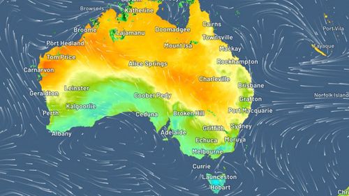
It comes as a low-pressure trough moves across the country’s south east over the next few days.
Here’s a breakdown of today’s weather.
There will be isolated showers and thunderstorms in the south and west of the state which will possibly be severe in the southern ranges.
It will be fine elsewhere with average temperatures.
Sydney will see a high of 26 degrees.
It will be cold and cloudy in the south but mild to warm in the north.
The Bureau of Meteorology said it will be mostly sunny elsewhere with some showers and thunderstorms in the east this afternoon.
Melbourne will reach a high of 21 degrees.
There are expected to be scattered showers and thunderstorms in the north as a monsoon trough develops today and into the weekend.
It’s forecast to be mostly sunny in the interior with moderate southeasterly winds.
”Maximum temperatures near or slightly below average, tending well below average across the northwest and the Peninsula,” the bureau said.
Brisbane will see a top of 29 degrees.
Read Related Also: How Anthony Morley Went From An LGBT Pageant Winner To Serving A Life Sentence For Murder
It will be mostly dry apart from showers and isolated thunderstorms in the north and northeast this afternoon.
The trough which sparked the sudden cool change after the state recorded its hottest day of the year earlier this week is clearing.
Adelaide will see a high of 24 degrees.

Western Australia will continue experiencing sweltering temperatures but rain will develop as a trough moves across the south of the state.
Ex-tropical cyclone Ellie is moving towards the south-east Kimberly bringing rain, showered and gusty thunderstorms with heavy rain and damaging wind.
Perth will reach a high of 35 degrees.
As ex-tropical cyclone Ellie moves towards Western Australia, the top end will still see rain and thunderstorms today.
It will bring possible heavy rain and damaging wind gusts.
A monsoon is also expected to “re-invigorate” today which will bring further rain to the territory.
Darwin will see a high of 31 degrees today.
The bureau forecasts possible light showers in the north and west but it will be fine elsewhere.
Hobart will reach a top of 20 degrees.
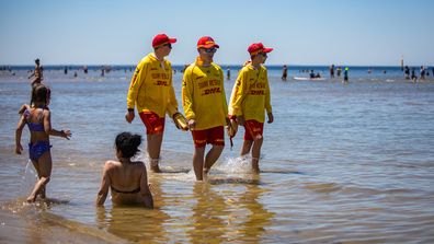
Post-Christmas heatwave brings back scorching Aussie summer