
Satellite images have captured rare images of three tropical cyclones spinning in the Pacific at once.
While Queensland waits to see whether the category 3 Tropical Cyclone Alfred will hit the state or not, two more Pacific cyclones have been spotted.
Tropical Cyclone Alfred is nearest to the Queensland coast, with Tropical Cyclone Seru hovering over Vanuatu, and Tropical Cyclone Rae to the south-east of Fiji.
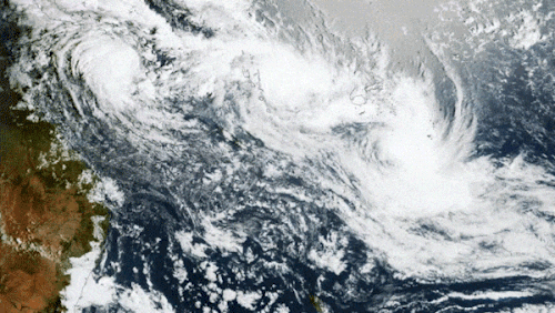
None of them are expected to hit populated landmasses over the next few days, but the clouds will cause rain and storms over some South Pacific islands, according to Weatherzone meteorologists.
Together, they form a band of cloud stretching for 5000 kilometres.
At 10am AEST (11am AEDT), Tropical Cyclone Alfred was about 810 kilometres from Mackay.
Bureau of Meteorology senior meteorologist Jonathan How said there was “high confidence” the cyclone would remain well offshore in the next two days.
“Beyond this, there are still a range of scenarios that could still play out,” he said.
How said it was possible the cyclone could approach the Queensland coast, or that it might stay well offshore.
Regardless, the Queensland coast is already feeling the effects of the storm.
Alfred now has winds of up to 130km/h at its centre, with gusts of up to 185km/h, and is slowly moving in a south to south-east direction.
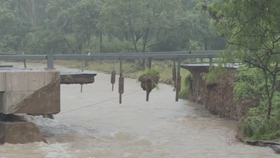
ADF to build temporary bridge to give access to flood-ravaged town
A strong wind warning is in place along the coast from Townsville to K’gari.
Large waves of two to three metres, and easterly swell of the same height, are expected along the same stretch of coast, with “large and powerful” surf conditions.
This will make coastal activities such as rock fishing dangerous, How said.