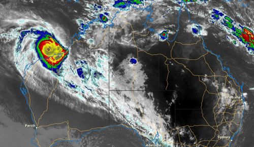
The Bureau of Meteorology has warned Zelia is “rapidly intensifying” as it moves west, just off the Pilbara coast, after reaching category four overnight.
There is a cyclone “watch and act” alert in place for residents in Bidyadanga to Dampier, including Port Hedland, Karratha and Dampier, and extending inland to Marble Bar.
Those living between Karratha and Bidyadanga, including Port Hedland, have been warned to watch for a dangerous storm tide as the cyclone rolls towards the coast.
The bureau said it expected the tropical cyclone to reach category five intensity sometime today as it moved to the north of Port Hedland.
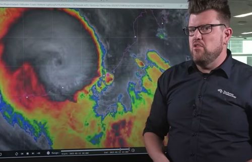
Senior meteorologist Dean Narramore said Zelia was a “very organised” and “very intense” tropical cyclone and already well on its way to reach the WA coast.
Damaging wind gusts reaching 290km/h and more than 500mm of rain are forecast for communities across the Pilbara coast from tonight, with the wild weather set to intensify tomorrow.
“Currently, a category four system has rapidly intensified overnight and likely to become a category five system later today,” Narramore said.
“We’re already seeing falls of 80 to 90mm around Port Hedland and even isolated falls in excess of 100, and we’re likely to see many more millimeters on top of that.”
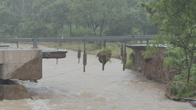
ADF to build temporary bridge to give access to flood-ravaged town
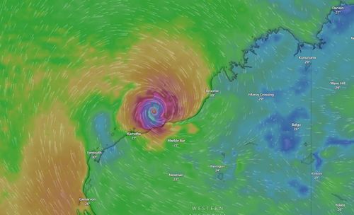
The destructive inner core of the cyclone is expected to cross the coast between Whim Creek and DeGrey, reaching Port Hedland, tomorrow afternoon and evening.
Tropical Cyclone Zelia is now about 140km north-west of Port Hedland and 240km north-east of Karratha.
Supermarkets are now working to get extra supplies into the region, about 1600km north of Perth, before roads are cut off.
An extra 40 emergency services personnel have been deployed to the Pilbara region as well as five flood boats with 10 crews, and four additional aircraft are on standby, including a rescue chopper with a winch.
Residents near the DeGrey river catchment and around the Shaw and Pilbara rivers have been warned to be on alert for flash flooding.