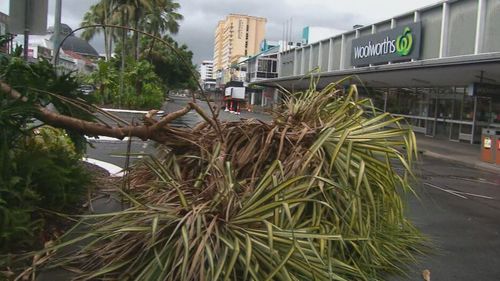
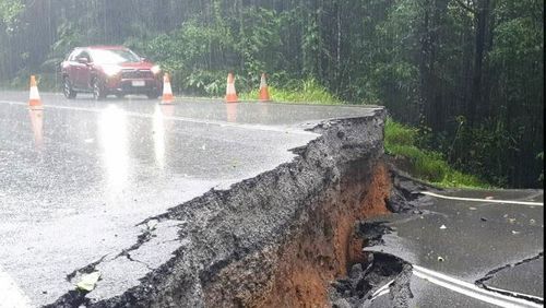
More wild weather is set to lash Australia’s north coast, as a new cyclone threat looms over Far North Queensland and a destructive monsoon heads towards the Northern Territory.
Meteorologists warned three tropical lows hovering above the northern tropics could trigger the potential for a tropical cyclone to develop later this week.
A monsoon trough developing off the Gulf of Carpentaria is expected to bring more heavy rainfall and flooding to regions recovering from the devastation wreaked by Cyclone Jasper less than a month ago.
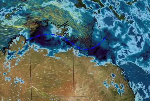
The monsoon has a 25 per cent chance of strengthening into a Tropical Cyclone, but that depends on the movement of another system forming west of Darwin (03U).
That tropical low will likely bring widespread heavy rainfall to the Top End or Western Australia’s Kimberley region in the coming days.
The Bureau of Meteorology has said the chance of the system strengthening into a tropical cyclone was low, but conditions are still being monitored.

SES warns Victorians of flood danger remaining days on from torrential rain
“A monsoon trough is developing across the Top End and adjacent waters with increased rain areas and thunderstorm activity,” the Bureau said.
“A tropical low may form along the trough, near southern Joseph Bonaparte Gulf, southwest of Darwin tomorrow or on Friday.”
Another tropical low (04U) is hovering off the North of Cocos Islands in the Indian Ocean.
The system at this stage poses little threat to the mainland but is expected to bring increased shower and storm activity as it moves further south to the west.
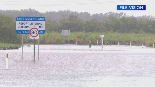
Meanwhile, regional Victoria remains under threat from floodwaters despite receding water levels, as the state deals with the aftermath of severe weather.
Torrential rainfall this week caused some areas in central and northern Victoria to receive more than three months of rain in a day, resulting in forced evacuations and the loss of dozens of homes.
Despite rainfall easing in the coming days and floodwaters receding, authorities said dozens of homes in the state’s north still remained at risk.
Several warnings remain in place, including a moderate flood warning for the Goulburn River, as water moves downstream from Shepparton.
Widespread moderate flooding is also expected to develop along the Bendigo Creek downstream of Minto.
Floodwaters are set to move downstream impacting Tandarra, Dingee, Prairie and Mitiamo, Pyramid Hill and Kow Swamp through to Friday.


![‘Marie Antoinette’ on PBS: Lamballe Reveals Yolande’s Secret to the Queen [Exclusive Clip]](https://celebjam.com/wp-content/uploads/2025/04/‘Marie-Antoinette-on-PBS-Lamballe-Reveals-Yolandes-Secret-to-the.webp-260x140.webp)