Thunderstorms are expected to lash parts of Queensland today as communities in the north still reel from the effects of Cyclone Jasper.
The new storms could become severe over the inland and central and southern districts, while the state’s Central Coast and Tropical Coast are also potentially in the firing line.
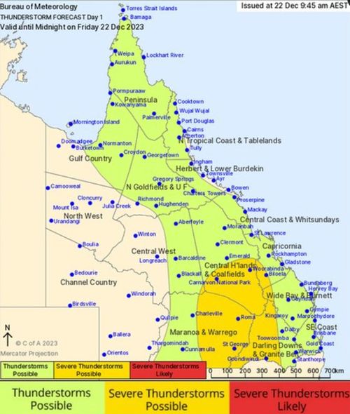
The Bureau of Meteorology said there was a risk of damaging winds, heavy rain and large hail in those regions.
Severe thunderstorm warnings will be issued if the storm reaches an emergency level. Residents have been told to monitor the bureau for updates through the day.
Read Related Also: Bruce Lehrmann defamation trial LIVE BLOG: Case enters its final stages as Brittany Higgins is spotted in Paris
Residents can expect wet weather until about midnight, as the storm moves over the alerted regions.
Other parts of the state are still on flood watch, including Cape York Peninsula where flooding is still likely today.
Meanwhile, the state’s north-west is under a heatwave warning until Sunday. Temperatures are expected to reach the mid- to high-30s in the Gulf Country, Northern Goldfields, Upper Flinders, Herbert, Lower Burdekin and North West Districts.