
A series of powerful cold fronts will bring rain, damaging winds, thunderstorms and snow to multiple states and territories across Australia this week.
It follows a freezing end to the weekend in Sydney, with Penrith recording its coldest morning in four years on Sunday as temperatures dipped to -0.3C.
Camden and Campbelltown recorded lows of -2.1C and -0.5C respectively. Further east, residents at Sydney Olympic Park woke to just 2.8C – the coldest morning there in two years.
‘We’ve had the high-pressure systems come over some still air… and it was just able to settle cold temperatures that are continuing,’ the Bureau of Meteorology’s Morgan Pumpa explained.
‘Wednesday through to even possibly Sunday or Monday does look very cold.’
According to Weatherzone, two major cold fronts and their associated low-pressure systems will move west to east across the country this week.
The first cold front arrived on Monday morning, bringing a cold, wet and windy start to the week in Western Australia.
Perth could struggle to reach 15C on Monday, which would make it the city’s coldest day so far this year.
This front will push into South Australia on Monday before sweeping across southeastern Australia on Tuesday.

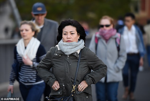
Sydney’s west shivered through their coldest mornings in years as still air and clear skies allowed temperatures to plummet (above, commuters in Sydney)

A series of cold fronts is sweeping across Australia’s south, bringing showers, gusty winds, and a drop in temperatures
Blustery winds, rain and cold air will follow across the southern half of the country from Monday to Wednesday, Weatherzone said.
Damaging wind warnings are already in place for parts of SA and Victoria, with potential warnings for NSW and Tasmania in the coming days.
This front will also interact with a low-pressure trough over eastern Australia, generating widespread rain and thunderstorms across NSW and Queensland on Tuesday and Wednesday.
The second cold front is due to reach southwestern WA on Wednesday, then move across SA and central Australia on Friday, before hitting southeastern and eastern Australia over the weekend.
It’s expected to form a large low-pressure system that will pull in tropical moisture, potentially creating a vast northwest cloudband.
‘This setup has the potential to generate a massive northwest cloudband that will soak part of every state and territory in the second half of this week.’

Forecast accumulated rain this week
In addition to widespread rain, the second front may bring more damaging winds to southern parts of the country and snow to the Alps – with even a chance of snow flurries in southern WA on Thursday.
‘The combined influence of this week’s cold fronts and low pressure systems will deliver a decent amount of rain to part of every state and territory in Australia between now and the weekend.
‘Due to the eastward movement of these weather systems, the bulk of this rain will fall on and west of the Great Dividing Range.
‘This means that the Murray-Darling Basin and many thirsty agricultural areas of SA, Tas, Vic and WA will also see a good drop of rain in the next seven days.’
Perth
Tuesday: Showers. Min 7C. Max 16C.
Wednesday: Showers. Min 8C. Max 18C.
Thursday: Showers easing. Min 6C. Max 14C.

Heavier snowfall is expected across alpine areas in Victoria and New South Wales over the weekend (above, Thredbo, NSW)
Adelaide
Tuesday: Showers. Min 9C. Max 13C.
Wednesday: Shower or two. Min 8C. Max 15C.
Thursday: Late shower or two. Min 8C. Max 17C.
Melbourne
Tuesday: Showers. Min 11C. Max 15C.
Wednesday: Mostly sunny. Min 5C. Max 14C.
Thursday: Mostly sunny. Min 4C. Max 15C.
Hobart
Tuesday: Showers increasing. Min 6C. Max 17C.
Wednesday: Partly cloudy. Min 6C. Max 13C.
Thursday: Sunny. Min 3C. Max 14C.
Canberra
Tuesday: Showers. Min 2C. Max 15C.
Wednesday: Partly cloudy. Min 1C. Max 13C.
Thursday: Morning frost. Partly cloudy. Min -3C. Max 13C.
Sydney
Tuesday: Possible shower. Min 11C. Max 20C.
Wednesday: Shower or two. Min 12C. Max 19C.
Thursday: Partly cloudy. Min 9C. Max 17C.
Brisbane
Tuesday: Shower or two. Min 13C. Max 22C.
Wednesday: Showers increasing. Min 13C. Max 22C.
Thursday: Sunny. Min 13C. Max 23C.
Darwin
Tuesday: Sunny. Min 19C. Max 31C.
Wednesday: Sunny. Min 19C. Max 31C.
Thursday: Cloud clearing. Min 20C. Max 31C.


