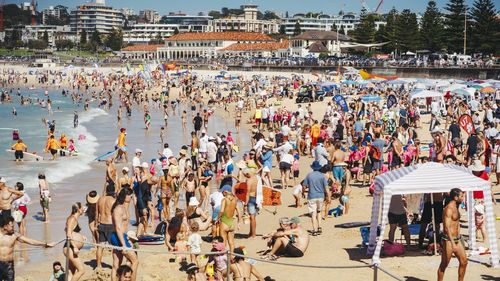
A southerly change that blew through Sydney yesterday afternoon brought an end to the city’s hottest start to March in over a century.
Weatherzone reports that before the mid-afternoon change that brought cool winds and rain across the city, Sydney had recorded nine consecutive days of maximum temperatures of 28 degrees or higher.
Yesterday, pre-rain, the temperature at Sydney’s Observatory Hill peaked at 32 degrees at 1pm.
Sydney will now hover at a maximum of 25 to 26 degrees until Monday, nearer the March average top of 24.8 degrees.
But already, it has been the second-hottest start to autumn for the harbour city in 160 years of records – and the hottest since 1915, Weatherzone said.
“Back in 1915, when Sydney had its hottest first two weeks of March on record, that fortnight included days with maximums of 37, 35, 38, and 36 (degrees),” the weather reporting site said.

Bushfires burning in Victoria’s west turn sky glowing red
“This March has been very different in Sydney, with no extremely hot days but a pattern of consistent warmth.”
Further south, Canberra has also had a warm start to the month, with an average top of 30 degrees – five degrees above the March average.
“Like Sydney, Canberra has seen no dramatic heat spikes over that period, with consistent warmth punctuated by a hottest day of 34.5,” Weatherzone said.