Winter’s chill is not done with Australia just yet with a “strong” cold front set to sweep over the south-east today.
The weather system is expected to bring the heaviest low-level snowfalls of 2022 as well as damaging winds and heavy rain.
The Bureau of Meteorology (BoM) said snow to 300m is possible for Tasmania and as low as 500m for the mainland.
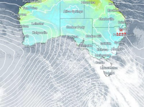
Satellite imagery shows a distinctive “speckled” field of clouds, which is an indicator of snow.
“These clouds form when very cold air moves over a relatively warm area of ocean, causing a large number of individual cumulus clouds to develop over a broad area,” Weatherzone said.
“Each of these cloud cells can produce rain, hail, snow and thunderstorms, with patches of clear sky in between.”
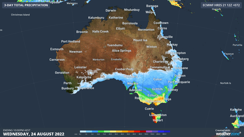
Over the next few days the cold front will deliver heavy rain and the potential for blustery thunderstorms.
“Rain will spread over a broad area of southeastern Australia during the next two to three days, with widespread falls of 10 to 30 mm and isolated totals above 50 mm, most likely in western Tasmania,” Weatherzone said.
Severe weather warnings and flood watches have been issued. Residents are urged to stay across the latest warnings here.
BoM warns “very cold air” will be felt across South Australia, Victoria, NSW, Australian Capital Territory and Tasmania as the cold front sweeps east.
Single digital lows will be felt in Melbourne, Adelaide, Canberra and Hobart.

Rare flurry of snow dusts Western Australia
Temperatures in Canberra and Hobart will plummet to 3C, while Melbourne will experience lows of 5C, and Adelaide 7C.
A low of 12C is forecast for Sydney tomorrow, it will be even colder Wednesday with the mercury dipping to 7C.