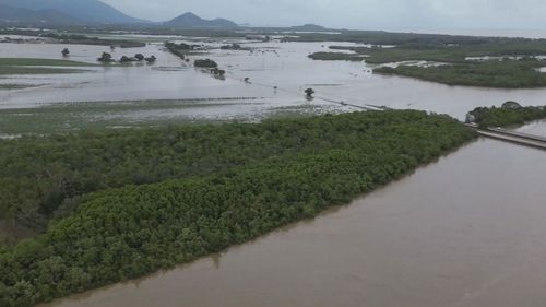
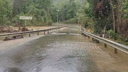
Roads are closed and water restrictions continue in parts of Far North Queensland tonight as a monsoonal trough crosses the state.
The rainfall is moderate but persistent, and tipped to continue for several days, leaving residents on flood watch once again.
The tropical low is less likely to develop into a cyclone as it crosses the state but the rainfall on already damp ground means many flood warnings remain across the far north.
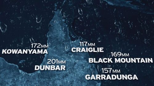
Rainfall totals were the highest around Cape York overnight, with Dunbar cracking 200mm.
Almost 170mm fell at Black Mountain near Cooktown – and it’s going to continue.
“This monsoon trough looks to hang around for the next few days, potentially even until the end of next week,” Shane Kennedy from the Bureau of Meteorology said.
“Potentially we may see a few places in that 100 to 150mm over the next few days.”
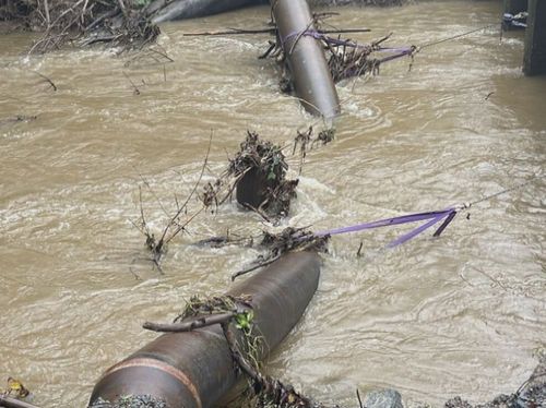
Meanwhile, a broken pipe triggered level four water restrictions for Port Douglas.
The deluge is setting back the recovery from the drenching caused by ex-Tropical Cyclone Jasper.
“We had hundreds if not thousands of landslips with the original event, we’ve had lots of landslips again,” deputy state recovery coordinator Mike Wassing said.
“We know we get a monsoonal event and a wet season and lots of rain.
“This is different because of the impacts on the communities that have been impacted already.”