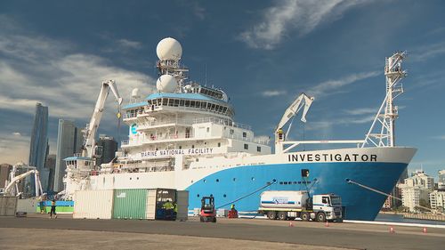
Sydney Harbour has had a glimpse at the nation’s most important vessel for ocean research, as it stops in the city before embarking on a voyage to map deep-sea canons.
CSIRO’s flagship Research Vessel Investigator usually takes off from Hobart, but on Friday it will leave Sydney’s White Bay for a 60-day trip to perform an extensive survey of deep-sea canyons and ocean currents off the NSW continental shelf.
RV Investigator will also perform a secondary mission to investigate an unidentified shipwreck off the state’s coast for Heritage NSW, Ship Management Program Director Sam Hinton said.
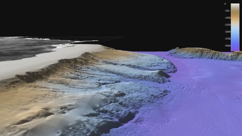
“We’ve only mapped around 25 per cent of the ocean around Australia. There’s still a huge amount to map,” Hinton said.
”We are constantly mapping the seafloor as well as obtaining our science goals around the coast of Australia up to the equator and down to the ice edge.”
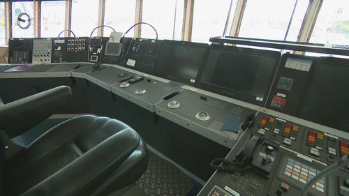
The boat runs with a crew of 40 and has a range of 10,000 nautical miles, which is about 60 days at a speed of 11 knots.
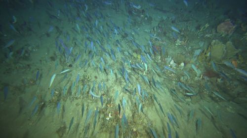
Scientists have found new marine life, studied the Antarctic blue whale and mapped up to 25 per cent of the sea floor surrounding Australia on the RVi.
The boat’s facilities allow scientists to map as deep as 11.5 kilometres, which is the same depth as the deepest known point in the ocean ever discovered – the Mariana Trench.
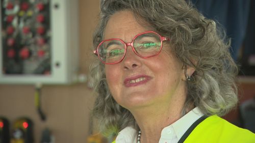
Chief Scientist Dr Bernadette Sloyan says the boat is “vital” to ocean research and is the place to be for marine scientists.
“It is the only marine research vessel that has the capabilities we need to do work on the shelf (and) off the shelf.”
“If you want to get time on the ship as a chief scientist, you have to put in a proposal two to three years in advance… that gets nationally and internationally reviewed.
The voyage that leaves on Friday will help scientists understand the relationship between underwater canyons and the East Australia Current to understand the changing ocean currents that surround the nation.