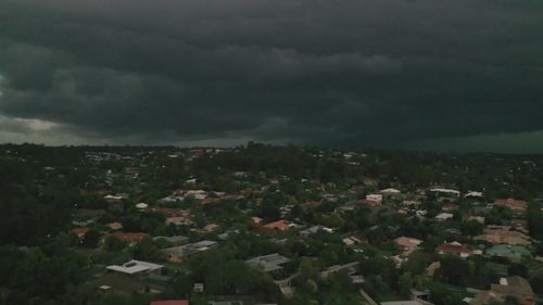
Three air systems colliding sparked lightning and torrential rain over south-east Queensland yesterday, but the region will continue to see lashing as a wet system moves over Australia.
Severe thunderstorms built out west yesterday, before travelling east and smashing the city.
More than 50 millimetres of rain was felt over parts during peak hour while lightning hit areas like Teneriffe, Regents Park and Boonah.
Pam Gill is lucky she wasn’t home as the bolts struck near her property.
“I actually saw the video and thought by the time we get there, our house will be gone. I thought it’d be gone up in flames,” she said.
“They said the bang was just absolutely enormous.”
But luckily for her, the extent of the damage wasn’t too bad.
It was a very lightning-active storm season.
From September this year to today, south-east Queensland felt 2.1 million lightning bolts, up from 780,000 in the same time last year.
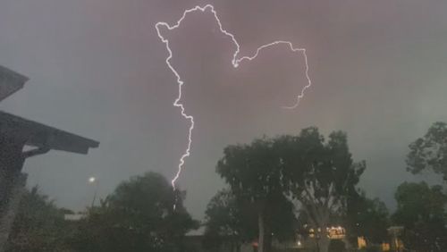
“It certainly was a very lightning-active storm that came through last evening,” Bureau of Meteorology’s Kimba Wong said.
About 36,000 homes lost power overnight with most of them restored by midday today.
“It has been a very active storm season and a number of years where we’ve had very active storm conditions,” Wong said.
“But what I must say is that we really must maintain vigilance.”
The next few weeks will see a rainy and stormy climate driver known as the Southern Annular Mode (SAM) which will make for a wet second half of November and even early December.
It will bring strong winds, cold fronts and a low pressure system.
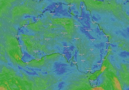
Rainfall and heavy thunderstorms are headed towards south-east Queensland over the next few days including damaging winds and hail.
Bureau of Meteorology senior meteorologist Christie Johnson said a trough lying from the state’s north-west down to the south-east could bring dangerous conditions.
:contrast(12):saturation(1.48)/https%3A%2F%2Fprod.static9.net.au%2Ffs%2Fac33da02-4ef0-4bba-9022-8df49cbc6aa2)
Mystery of pink sand washing up on South Australia’s beaches solved
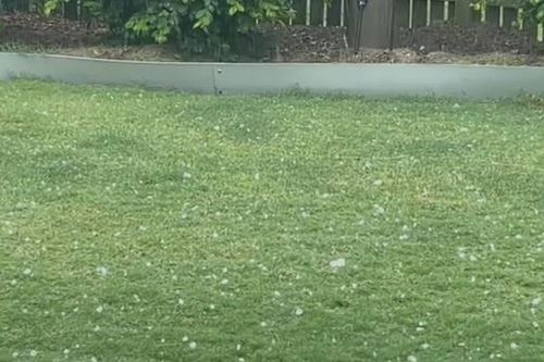
“There’s actually even a slight risk that we could see giant hail, which is over 5cm, particularly areas around the Sunshine Coast Hinterland and the South Burnett,” she said.
Thunderstorms will also hit Western Australia with severe weather travelling through inland areas over the next 24 hours.
Jonson said the most impacted areas will be inland such as the Pilbara, Gascoyne and Goldfields regions.
“The severe phenomenon we’re most likely to see with storms over WA today is damaging wind gusts with gusts in excess of 90km/h,” she added.
“All the thunderstorm activity today will be closely monitored and warnings will be issued as soon as any storms show signs of producing this sort of severe weather.”
WA is set to be hit the hardest in tomorrow’s forecast and storms will also roll in across the Northern Territory, parts of New South Wales and Queensland.
There is also an expected cold front set to bring a risk of storms in South Australia and Victoria on Saturday.
Wild weather hit south-east Queensland yesterday, with damaging winds, torrential rain and some hail battering areas along Ipswich, Logan and Brisbane City.
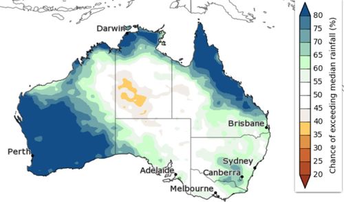
A Southern Annual Mode (SAM) is a climate driver that influences weather patterns in weeks-long periods.
SAMs in a positive phase can bring westerly winds, cold fonts and a low-pressure system in southern areas.
Forecast models have predicted this weather system may linger even into December.


