
Satellite photographs revealing the scale of the devastating flooding in central-western Queensland have been released by NASA.
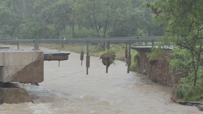
The once-in-a-lifetime weather event has been disastrous for farmers, with huge areas of land inundated and more than 140,000 head of livestock lost or killed.
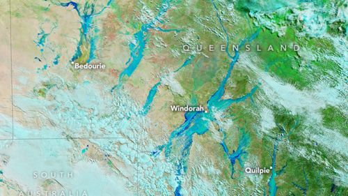
The NASA images provide a snapshot of the flooding at Cooper Creek, near the small outback town of Windorah, last month.
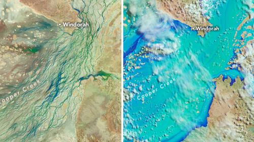
The space agency’s Landsat 9 Operational Land Imager (OLI) took photos on March, while its Landsat 8 satellite photographed the area on March 29 after heavy rainfall.
In the false-colour images, water is shown as dark and light blue, while bare land is brown and green represents vegetation.
This week showers have eased in outback Queensland but the conditions remain devastating for farmers and residents.
ADF to build temporary bridge to give access to flood-ravaged town
Rainfall totals have dropped from the triple digits into the double digits in most affected towns but despite the decrease, creeks and rivers are still rising and flowing.
The small town of Adavale was swamped suddenly last week and had to evacuate to the nearby town of Quilpie.
They will have to continue to wait to return as authorities work to clear the damage.
The Bureau of Meteorology says a weak trough will linger across central and northern Queensland today before contracting northward over the weekend.
During the coming weeks and months, the floodwaters will drain towards Lake Eyre, also known as Kati Thanda-Lake Eyre, about 600km south-west of Windorah. The lake sits at the lowest natural point in Australia and is dry most of the year.