Residents in the nation’s north are being urged to be aware of potential floods and road closures, particularly in isolated areas.
“The largest rainfall totals on Monday and Tuesday are expected to fall across the central NT and central and northern Queensland, including the Mackay, Isaac and Whitsunday regions,” Weatherzone said.
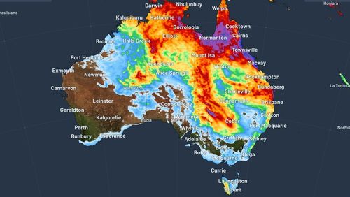
Falls of up to 100mm are expected in parts, with more widespread rain of 30mm to 50mm in Queensland, the Northern Territory, and Western Australia, over the next 48 hours.
It follows recent heavy rain in the NT after Cyclone Megan made landfall last week.
“Later this week, this rainfall is expected to shift further south and east as the trough extends into NSW and South Australia,” Weatherzone said.
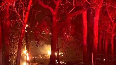
Bushfires burning in Victoria’s west turn sky glowing red
Western NSW and north-eastern South Australia are expected to cop the brunt of this extension.
Satellite images also show that the moisture over north-eastern Australia is also feeding a long band of cloud stretching over 7000km from the NT to the east of New Zealand, Weatherzone said.
FOLLOW US ON WHATSAPP HERE: Stay across all the latest in breaking news, celebrity and sport via our WhatsApp channel. No comments, no algorithm and nobody can see your private details.