
Multiple states are facing wind gusts of up to 125km/hr across Australia’s south-east, as the “most powerful cold front of the year” moves in.
A video update by the Bureau of Meteorology yesterday said dangerous winds above 90km/hr, with damaging gusts reaching the upper 125km/hr limit, were expected across southern South Australia, Victoria, the NSW Snowy Mountains, and parts of the ACT.
After winds extended across the South Australia coast yesterday afternoon and evening, they’re expected to sweep across Adelaide today, and into Victoria and NSW.
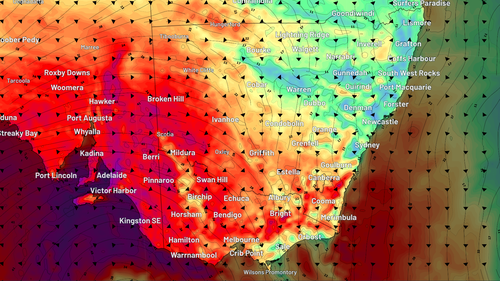
They’re set to ease by later today and into Tuesday, but NSW will remain at risk into tomorrow, including in the state’s east, where more showers are forecast, including for flood-hit areas.
The Bureau of Meteorology warned that trees were “weak” across south-east Australia after months of dry weather and drought conditions, leaving them vulnerable to strong winds.
Powerlines could also be toppled, interrupting the electricity supply.
And there’s a risk of raised dust in lower regions and even blizzards in alpine districts where the cold front is forecast to bring snow.
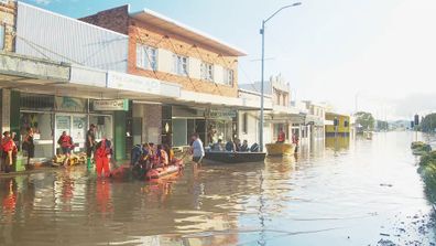
Locals help with rescue efforts as parts of NSW still underwater
Dangerous coastal conditions are also expected, with waves of up to eight to 10 metres forecast for South Australia, including Adelaide.
Abnormal high tides will besiege Victoria today and tomorrow, potentially triggering coastal damage and beach erosion.
People are urged to stay up to date with weather warnings at the Bureau of Meteorology website.