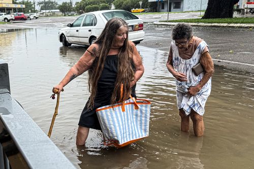
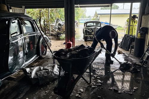
Thousands of people across flooded north Queensland are facing a huge clean-up of their homes and businesses, but more rain on the way could hamper their efforts so far.
Hundreds of millimetres is on the way for parts of the embattled region tonight and tomorrow after some areas just copped another 400mm on the weekend.
Where floodwaters have receded, mould has already began to spread and streets are lined with destroyed furniture and belongings.
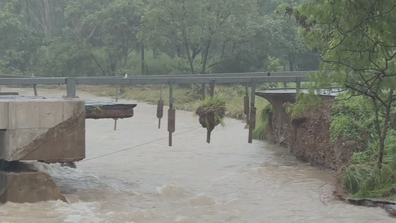
Residents in some communities have been without power for 10 days and hundreds of roads across the region remain cut off.
A severe weather warning for heavy to locally intense rainfall and potential flash flooding extends from Innisfail into the Gulf Country, southern Peninsula, Northern Goldfields and Upper Flinders
Six hourly rainfall totals between 150 to 180 millimetres are likely with the potential for 24-hour rainfall totals in excess of 250 millimetres.

“The heavy rainfall has eased across the Queensland coast, but we are expecting it to re-intensify tonight and become more widespread into Tuesday,” meteorologist Sarah Scully from the Bureau of Meteorology said.
“There are also high tides about the Gulf Coast and the and the Torres Straits that may lead to minor flooding and inundation of low lying areas.
ADF to build temporary bridge to give access to flood-ravaged town
“It is an evolving weather situation and grounds are very wet, river systems are swollen, they’re going to respond very quickly to any rainfall that falls over the area, and it’s very likely that these warnings and watches will be updated in the coming days, so it’s important to stay up to date.”
Moderate to major flood warnings are in place across areas of the North Tropical Queensland coast, including for the Herbert, Burdekin, Cape and the Flinders rivers.
The region officially recorded its highest February rainfall total – 1033mm – in just the first week of this month.