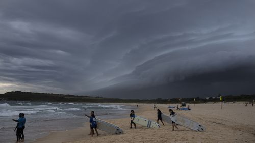
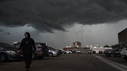
Heavy showers and storms are hitting Sydney, with warnings of flash flooding for much of the NSW coast.
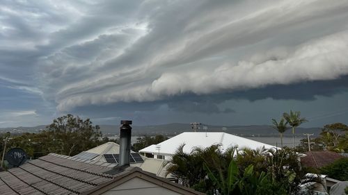
Storms have already dampened parts of north-west Victoria, southern New South Wales, the Australian Capital Territory and Tasmania overnight, with thunderstorms expected to continue this afternoon and evening.
Hail has hit areas of the Hawkesbury, with shots from Bilpin showing lawns covered with ice.
Large hail and damaging winds have also been forecast by Weatherzone, and Marine Wind Warnings have been issued for NSW, Victoria, and Tasmania by the Bureau of Meteorology.
The expected thunderstorms are part of a ”prolonged storm outbreak” that has been lingering over Australia’s east coast since last week.
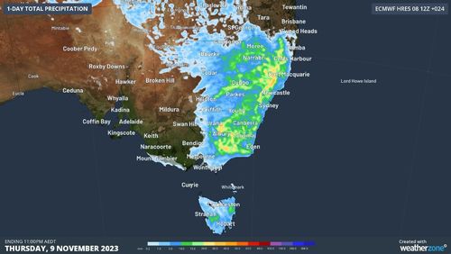
Overnight, Albury, on the southern New South Wales border, saw 41mm of rain, breaking a three-week drought.

Braidwood, east of Canberra, had 31.6mm of rain, marking the heaviest day of rainfall in a year.
Read Related Also: Commissioner's son in serious condition after hit by car at schoolies
Lightning is expected to spread over the region later in the day into the evening.
Showers and storms are expected to stick around for the next week, as humid easterly winds and low-pressure troughs fuel the wet weather.
Queensland and New South Wales detected more than 1 million lightning strikes over the weekend.
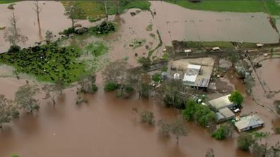
Fires to floods: Wild weather hits Australia’s east-coast
The Bureau of Meteorology’s November drought statement showed just how parched the country is, with some areas experiencing record-low levels of rainfall.
Nationwide, October rainfall was the fifth-lowest since 1900 – down 65.4 per cent on the long-term 1961-1990 average, and every state and territory except Victoria dropped below their own averages.