
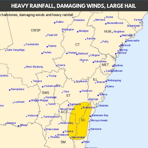
Parts of northern inland and eastern Queensland along with eastern NSW are bracing for more thunderstorms which could lead to flash flooding, hail and damaging winds.
The Bureau of Meteorology issued a severe storm warning as a cold front heads across the east over the next few days, with ‘giant’ hail expected to smash parts of NSW.
“Any severe storms could lead to flash flooding, damaging wind gusts and large hail,” said senior meteorologist Miriam Bradbury.
“We may even see locally giant-sized hail about parts of the Central Tablelands of NSW if those severe storms really get going this afternoon.”
As NSW and Queensland prepare for another wave of storms, the ACT and Canberra are also expected to be hit with severe thunderstorms this afternoon and evening.
All the Australian towns with record-breaking weather events
Coastal areas of NSW including Sydney, Wollongong, Newcastle and Brisbane are less likely to see severe storms but moderate rain and thunder is still on the cards.
The worst of the damaging thunderstorms remain further inland, the bureau said.

The thunderstorm risk is high for eastern parts of Victoria tomorrow.
“The risk will extend into eastern parts of Victoria, including the Yarra and Dandenong Ranges and parts of east Melbourne,” Bradbury said.
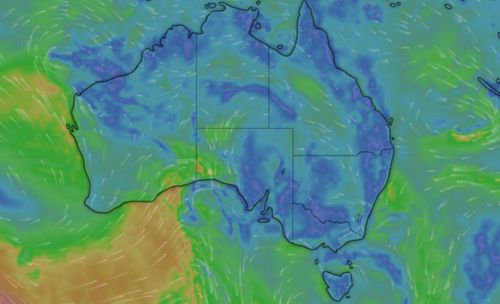
The chance of rain across the east coast remains high as a cold front moves in from from the south-east.
Heavy rain will ramp up across eastern Victoria and south-east NSW.
“A widespread 20 to 40mm is possible, with storm-driven rainfall totals likely to be quite a bit higher through that far south-eastern part of the continent,” Bradbury added.
Conditions aren’t expected to ease until the weekend.
Further rainfall is forecast on the NSW coast on Saturday and Sunday if the low-pressure system is exacerbated by strong southerly winds.
It follows several days of intense rain across parts of the eastern seaboard.
Thunderstorms, flash flooding and lightning smashed the region overnight.
The Central Highlands in Queensland was battered by winds reaching 94km/h, while heavy rain and storms lashed parts of NSW and the ACT.