Multiple states have been warned to brace for another polar blast sweeping across the country, bringing the threat of hail, blustery winds, rain and snow as temperatures plummet.
The forecast comes after Melbourne recorded it’s coldest six-day May spell in 42 years, with temperatures failing to climb past 15 degrees between last Tuesday and Saturday.
There’s no end to the chilly conditions in sight as a “frigid air mass” is set to cross the country from today.
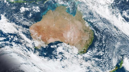
“(It) will cross the Bight on Wednesday before barrelling across southeastern Australia on Thursday and Friday,” Weatherzone said.
Strong, potentially destructive winds will be a hallmark of the system.
“Damaging gusts possible in parts of Tasmania, Victoria, NSW and the ACT from late Wednesday into Thursday, most likely in exposed coastal areas and about the ranges,” Weatherzone said.
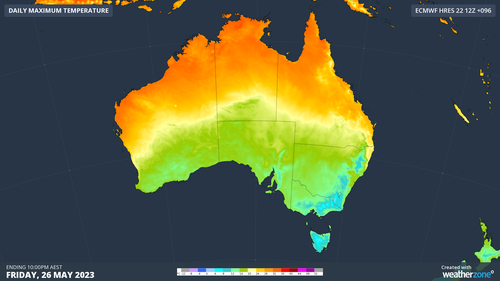
Temperatures will be noticeably cold, exacerbated by these strong winds.
“Daytime temperatures are expected to be around 4 to 6C below average for large areas of southeastern Australia by Friday,” the weather service said.
“This cold snap will be exacerbated by wind chill, making it feel more like 10C below average in some places.”
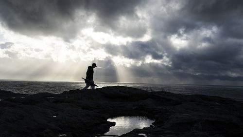
Sunny conditions will also deteriorate as the system passes over.
Read Related Also: 49ers’ Brandon Aiyuk believes Chiefs will ‘expose’ Eagles in Super Bowl 2023
Melbourne and Hobart have rain on the forecast for Thursday, while Sydney will be hit with a “shower or two” on Friday, according to the Bureau of Meterology (BoM).
Canberra also has a high chance of showers on Friday.
That precipitation will prove to be frozen gold for the alps, as snow will begin falling over Tasmania, Victoria, NSW and the ACT from Thursday and run into Friday.
Weatherzone added snow could possibly reach into parts of northern NSW.
“The best chance of snow on the northern highlands of NSW will be on Friday morning as the cold air surges north,” it said.
“At this stage, snow could fall to around 600 metres elevation in Tasmania, 800 metres in Victoria and about 1000 metres in southern and central NSW and the ACT”.
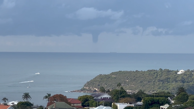
Big waterspout spotted off iconic Sydney beach
Sign up here to receive our daily newsletters and breaking news alerts, sent straight to your inbox.