Much of Australia is facing another wet day, with Sydney inching closer to setting a new all-time annual rain record.
The record of 2194mm is expected to be surpassed by this weekend, with falls of up to 49mm in the city overnight.
The rain is set to continue today, with predictions of 10-15mm in the CBD.
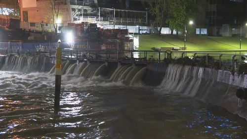
Residents are being urged to prepare as flood warnings remain in place throughout NSW, including the Upper Hunter, Lower Hunter, Darling River, Murray River and the Lachlan River.
The SES has already carried out a number of rescues and is warning people to avoid floodwaters.
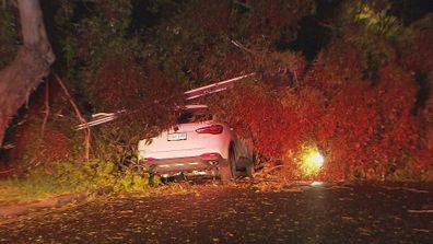
NSW isn’t the only state in the firing line, with rain and storms forecast right around the country.

Today, showers and isolated thunderstorms are set to develop in the afternoon and evening across southern Queensland, much of NSW, and Victoria, the Bureau of Meteorology has warned.
Read Related Also: Gemma Owen is ‘in talks for her own reality show’ following her split from Luca Bish
Northern Tasmania may also see moderate to heavy rainfall.
Severe thunderstorms with damaging winds, heavy rain and large hail will be possible in south-west NSW and western Victoria today.
SES clean-up Adelaide after wild weather hits the city
Across South Australia the next cold front will bring another band of showers and isolated storms across the state.
Many communities that recently experienced flooding or are currently in flood will likely see rivers rise in the coming week.
The ground remains saturated, and any additional rainfall will cause streams and rivers to rise, the BoM has said.