The low-intensity heatwave is expected to peak today in two states before calming slightly, with temperatures set to skyrocket again on the weekend.
From Thursday onwards, meteorologists have forecast temperatures in some regions in the east to soar between four and 12 degrees above average.
/https%3A%2F%2Fprod.static9.net.au%2Ffs%2F7fd84316-29c5-41e3-9206-0cd922629119)
Gusty conditions associated with a mix of troughs bringing warm air across the country will gradually start to heat up southern states such as Victoria and South Australia as well in the coming days.
In Sydney, some parts of the city’s west will reach almost 40 degrees today, while the metro will sizzle through temperatures around the 35 degree mark.
In Brisbane, it’ll be a steamy 34 degrees and sunny, at the Gold Coast it’ll be a similar 31 degrees, Canberrans will see a cloudy but humid day with temperatures expected to reach 29 degrees, it’ll be 28 and partly cloudy in Melbourne, 26 and fine in Adelaide and 26 degrees with a chance of showers in Perth.

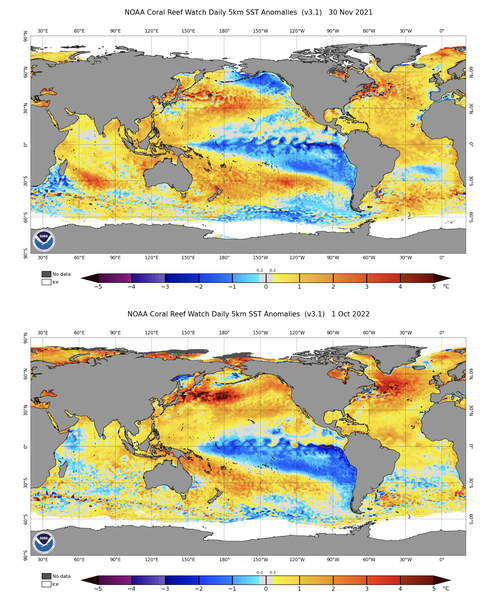
Meanwhile, fresh data has revealed global ocean temperatures have “rebounded” to record-challenging highs this week, as the planet brushes off the cool influence of La Niña.
Read Related Also: How Much Does A Ticket To The Met Gala Actually Cost?
“Earth’s ocean temperatures have been rising in recent decades due to the ongoing warming influence of climate change,” Weatherzone said.

“According to data from the US National Oceanic and Atmospheric Administration (NOAA), the global ocean temperature has increased by around 1 degree since 1900 and about 0.6 degrees since 1970.
“This background oceanic warming has been masked during the last two-to-three years by to the cooling influence of La Niña.
“However, La Niña is now over and our planet’s average ocean temperature has started to increase at an alarming rate.”

Record heat in NSW sparks bushfires


