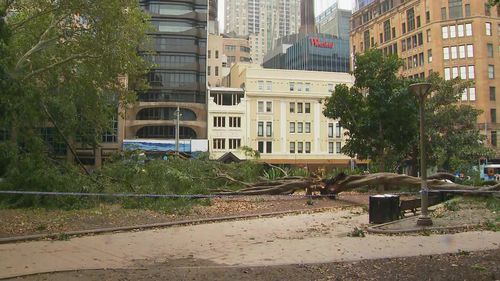
Two people have been injured after strong winds knocked over a tree in Sydney’s Hyde Park as wild weather lashes the city.
The tree came down at the park on Elizabeth Street and Market Street in Sydney’s CBD, near St James train station.
Two people are being treated for minor injuries.
The SES has been called 1572 times alone to the CBD alone due to damage from the strong winds, while hundreds more calls were made from Bankstown, Parramatta, Hornsby, Ku ring gai and Ryde, which were some of the worst affected.
There have also been 600 other callouts in other suburban areas across Sydney.
Earlier today ferries were cancelled and residents were warned to stay away from the sea as a low-pressure system lashes parts of NSW.
Huge swells are impacting most of the east coast including Manly, Coogee and Bondi beaches, with waves reaching a reported 4.9 metres in Sydney.
Ferries across Sydney have been cancelled due to unsafe conditions including the Manly, Mosman Bay, Blackwattle Bay and Taronga Zoo services.
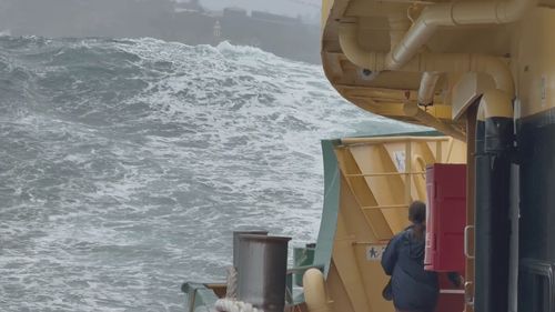
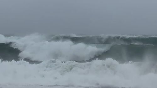
The waves are expected to get even bigger throughout the day, the Bureau of Meteorology said.
“Strong south to southeasterly winds are likely to drive large, powerful southerly waves today and overnight tonight,” BoM said in a statement.
“Very heavy surf which may lead to localised damage and coastal erosion is likely about exposed coasts between Ulladulla and Smoky Cape today and tonight.
“Beach conditions in these areas could be dangerous and people should stay well away from the surf and surf-exposed areas.”
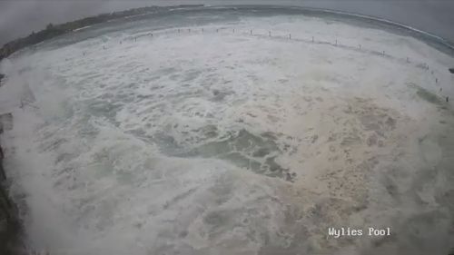
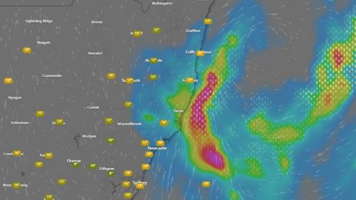
Damaging winds have already started hitting the state, stretching from Kempsey to Southern Sydney.
Wind gusts have already hit 72km/h in Newcastle at 10am, while Sydney airport and Kurnell were lashed with 91km/h winds at 9.50am.
At Wattamolla, in the Royal National Park, wind gusts hit a peak of 106km/h by 10am.
Severe thunderstorms are set to combine with a low-pressure weather system over the east coast and bring significant rain through to Sunday.
Residents should expect damaging winds to continue today, averaging 55km/h to 65 km/h, but they could possibly be up to 90km/h in exposed coastal areas.
Gusts are expected to increase during this morning, peaking in the afternoon, before they ease this evening.
Large parts of NSW can also expect a soaking today, with heavy rainfall and flash flooding forecast for the northern Hunter and Mid-North Coast, particularly in the afternoon and evening.
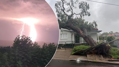
Wild storms rip up trees as tens of thousands in NSW still without power
The NSW SES has issued a watch and act warning for severe storms in northern NSW as rainfall totals of up to 200mm in a 48-hour period are expected.
“Over the next 48 hours, the most severe weather is expected to impact the area from Port Stephens to South West Rocks, as well as the far north-east of the state,” NSW SES Commissioner Mike Wassing said yesterday.
“People should prepare themselves now, know their risks and never drive, walk, ride or play in flash flooding should they come across a flooded road or causeway.”
Beachgoers are being warned of damaging surf conditions in coastal areas between the Illawarra and the Mid-North Coast.
In Queensland, severe storms are forecast today for the Burdekin and much of the Central Coast and Whitsundays, with the bureau warning of large hail and damaging winds.
Possible storms are also forecast for most of northern, and parts of central and south-east Queensland over coming hours.
Hails earlier this week smashed the Gold Coast and 25,006 properties lost power in the state’s south-east.


