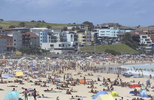
A week of extreme weather is ahead for Australia, as the start of the week will bring a heat wave and fire warnings, while the end of the week will leave some states bracing for snow.
Temperatures are expected to reach the high 30s in eastern New South Wales and southern Queensland, with eastern Victoria expected to hit the high 20s and Tasmania expected to reach the mid 20s.
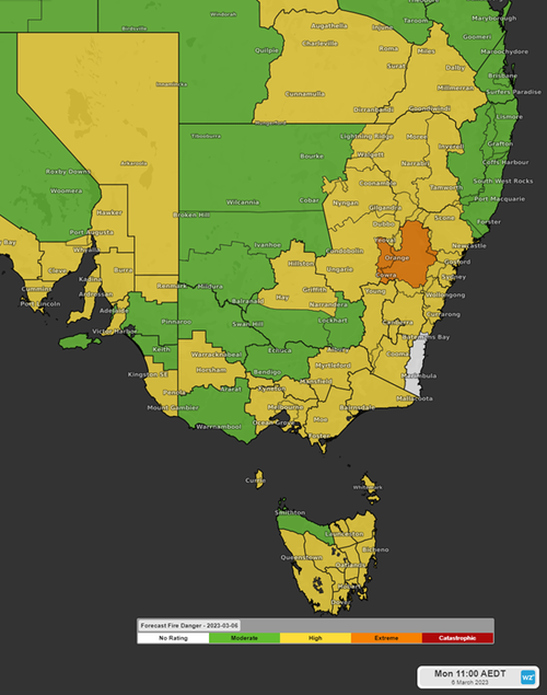
The low-pressure heat trough will move north-westerly across Queensland, western and central New South Wales, and the lower eastern states.
Then it will move southwesterly through northeastern South Australia and western New South Wales.
As it does it will bring winds of up to 50km/h, contributing to a high fire warning rating.
Residents across all the eastern states have been warned to monitor for updates.
The fire danger is expected to stay high until a cool southerly wind moves across the region on Tuesday, possibly Wednesday.
After the heat comes snow
Australia will then face a flip in weather conditions, with the southerly cold front due to bring strong winds, rainfall, and Tasmania’s first autumn snowfall by Tuesday or Wednesday.
Read Related Also: Is ‘Cocaine Bear’ Streaming on HBO Max or Netflix?
The cold front will hit southeast South Australia, Victoria, Tasmania and southern New South Wales, bringing bursts of strong and wild winds, expected to peak at 90km/h.
Tasmania is anticipating its first snowfall of March, with the cold airmass cold enough to generate around 700-800mm of snowfall, expected on late Tuesday and early Wednesday.
Temperatures in the south eastern states are expected to drop to 14 degrees, with Tasmania bearing the brunt of the flip.
Adelaide, Melbourne and Canberra are expected to drop to the high teens to low 20s.
Meanwhile, southern and central Western Australia will remain rainy and windy, with a high-pressure trough moving slowly through the state, bringing thunderstorms and strong winds to the area.
Ningaloo Coast, Geraldton Coast, Lancelin Coast and the Perth Coast have been issued a strong wind warning, which is expected to remain through Sunday and Monday.
The Northern Territory is facing a tropical low over the territories northeast, bringing rainstorms and windy conditions, but the low will not impact the temperature.
Darwin can expect hot weather from Sunday March 5 to Saturday, March 11, peaking at 33 degrees on Saturday as thunderstorms lash the territory.
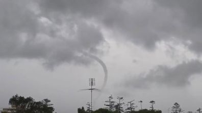
Huge Sydney waterspout leaves locals rubbing eyes in disbelief
Sign up here to receive our daily newsletters and breaking news alerts, sent straight to your inbox.