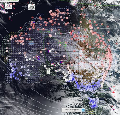
Australians living in the Top End, Western Australia and northern Queensland were hit with above-average temperatures for early November this morning.

Darwin is set to reach a maximum of 35 degrees today while Brisbane is forecast to reach a maximum of 30 degrees.
Heatwave conditions also impacted huge swathes of northern Australia yesterday.
Parts of inland Queensland hit temperatures in the 40s, including Richmond, Mt Isa, Longreach and Boulia.
Meanwhile, Tasmania’s Mount Wellington recorded a minimum of 0.8 degrees and a smattering of snow in the island state this morning.

Tomorrow will see similar conditions with a minimum of -1 degrees forecast for the Kunanyi/Mount Wellington area tomorrow.
Looking ahead, the Bureau of Meteorology issued a severe heatwave warning for parts of the NT until Tuesday.
:contrast(12):saturation(1.48)/https%3A%2F%2Fprod.static9.net.au%2Ffs%2Fac33da02-4ef0-4bba-9022-8df49cbc6aa2)
Mystery of pink sand washing up on South Australia’s beaches solved
“Isolated pockets of extreme heatwave conditions are expected to develop over western parts of the Top End in the coming days before easing from the middle of next week,” the bureau said.

Queensland has been issued a similar warning for central and northern parts of the state.
Clermont, Cloncurry, Croydon, Doomadgee, Longreach, Mount Isa, Roma, Toowoomba, Winton and Warwick are most likely to be impacted by temperatures between high 30s and mid-40s.
The heatwave is forecast to continue with temperatures not cooling below 30 degrees in the impacted areas.
Some night time temperatures in the south, including south-east NSW, the ACT, Victoria and Tasmania may drop below 10 degrees.


