Queenslanders are being warned to brace for the remains of ex-tropical cyclone Ellie as heavy rainfall continues to move east over the country.
In coming days, the remnant of the system will move to Queensland, bringing widespread rain and thunderstorms to northern, central, and eastern parts of the state, Dean Narramore from the Bureau of Meteorology said.
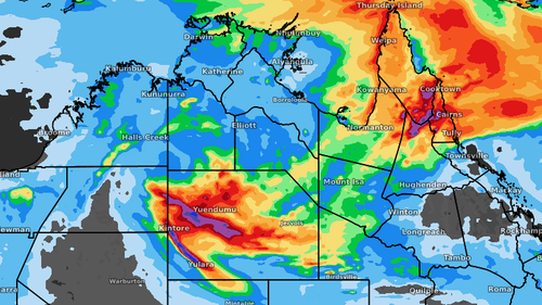
The main centre of the weather activity will be around the tropical north, including Cairns and the Gulf of Carpentaria, reaching south into Longreach and possibly Mackay.
Narramore said this area should see 50mm-100mm of rain but isolated falls of up to 200mm were possible on the coast.
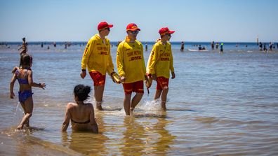
In Victoria, meanwhile, the situation is very different with the state facing high temperatures and a possible heatwave.
Narramore said temperatures between the high 30C and low 40C range would be in place in parts of Victoria, including along the Murray River.
Read Related Also: Bing's chatbot is really scary
Post-Christmas heatwave brings back scorching Aussie summer
“That is going to continue all week,” he said.
Toward the end of the week, full heatwave conditions could develop across Victoria, South Australia, and Western Australia.
“Much of Australia is likely to be in the high 30Cs, low 40Cs, moving towards the weekend and into next week as well,” Narramore said.