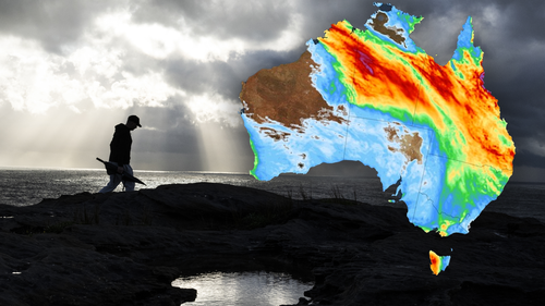
Some areas, according to Weatherzone, had already collected several months’ rain in one or two days earlier this week, resulting in flooding and roads being off.

While the nation enjoyed some respite from the rain yesterday, those conditions are to be short lived, with more intense conditions expected today and into the weekend.
“Another pulse of heavier rainfall will develop over WA’s Kimberley and the NT Interior on Friday and Saturday, before spreading further east across Queensland from Sunday into early next week,” Weatherzone said.
“Some forecast models also suggest New South Wales, Victoria, the ACT and even Tasmania could pick up some rain from this system next week.
“As of 4pm AEST on Thursday, flood watches had already been issued in WA and the NT.

“More flood watches and possibly flood warnings will be issued in the next few days as this second pulse of rain spreads across northern and central Australia.”
The expected dumping comes as Bureau of Meteorology (BoM) issues warnings to every Aussie state and territory today over extreme marine winds.
Read Related Also: Radio host Natalie Jones finds mystery man she kissed at festival
Flood warnings also remain in place across a number of areas in WA, the NT and in Victoria.

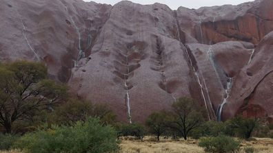
‘Magical’ waterfalls appear on Uluru after outback soaking
Meanwhile, across the capital cities, it’ll be tops of 18 degrees today in Sydney with lows of a frosty seven, in Melbourne it’ll be cloudy with tops of just 14 and a low of 10 degrees.
In Brisbane, it’ll be a pleasant 21 and sunny, with lows of six, while in Adelaide rain is expected with tops of 13 degrees.
In the west, Perth will see sunny skies with a maximum temperature of 17 degrees, and in Canberra it’ll reach a high of 11 degrees.
Showers with a top of 14 degrees is expected in Tasmania.


