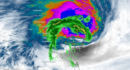
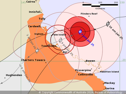
The intensifying cyclone is currently 155 kilometres east-north-east of Townsville and is travelling at 24km/h towards the north coast, where it will make landfall around 8pm.
It has brought with it damaging wind gusts of 165 kilometres per hour, with fears heavy rainfall and a risk of flash flooding will shortly follow.

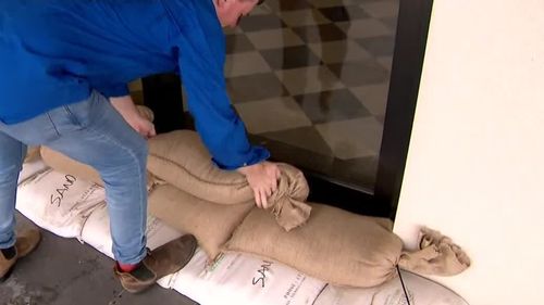
Residents have begun preparing their homes for yet another devastating weather event, with prisoners from Townsville Correctional Centre making sandbags for authorities to distribute.
“I’ve done most of my prep. I’ve grabbed my sandbags and maybe a couple more batteries,” one resident said.
“We’re just going to keep a cautious eye on the weather and go with the flow that way we have precautions of sandbags,” NightOwl convenience store owner Roz Woodham said.
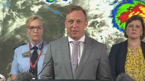
Premier Steven Miles earlier today urged residents to act and prepare.
“Make sure your emergency kit is stocked. Make sure that you have enough essential items to potentially have to get through days without power,” he said.
“If your home is not safe, please make the decision early to get out of it.”

There have already been 146 calls to SES for help – largely from the Charter Towers, Townsville and the Whitsundays region – and 50 residents have chosen to self-evacuate.
Disaster declarations were issued for both Townsville and Mackay while a number of schools in the cyclone’s firing line were closed today.
“We have pre-emptively requested assistance from the Australian Government and other states, including aerial assets and defence support,” Miles said.
“There has been an extraordinary amount of preparation work.”
Kirrily will bring torrential rain, flash flooding and damaging winds with it, the Bureau of Meteorology’s Laura Boekel said.

“As we move through this morning and into the rest of today and this evening, these gales with damaging winds will begin to affect more areas on the mainland,” she said.
“Areas between Sarina and Ayr will start to see these stronger winds from this morning while areas further north between Ayr and Innisfail, which includes Townsville, will then start to see these winds during this afternoon and into this evening as we see that system moving towards the coast.”
Isolated rainfalls of up to 300 millimetres are expected as the system crosses the coast.
After the cyclone makes landfall, it is forecast to weaken into a tropical low tomorrow as it moves inland.

Deputy Commissioner Shane Chelepy confirmed the federal government is expected to provide assistance as early as 4pm today.
“While the preparations have been undertaken over the last couple of days, today is the time to decide whether or not you’re going to stay within your house,” he said.
“Please make that decision today as the cyclone crosses the coast this evening with heavy rain and wind, it becomes unsafe in the hours of darkness to be on the roads.”
The bureau will be providing hourly updates until Cyclone Kirrily makes landfall today.
Residents are urged to keep up to date with the current warnings.


