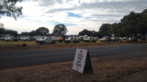
It comes as the state faces dangerous fire conditions and severe thunderstorms again today, with high temperatures and strong winds triggering a total fire ban.
The dangerous fire is currently burning between Ballarat and Ararat on the Bayindeen-Rocky Road at Bayindeen, in the Pyrenees Ranges.

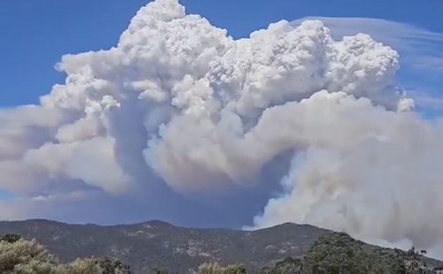

The state emergency service issued the emergency warning for communities at Ballyrogan, Bayindeen, Beaufort, Buangor, Buangor East, Challicum, Cross Roads, Eurambeen, Lake Goldsmith, Langi Kal Kal, Main Lead, Middle Creek, Mount Cole, Nerring, Raglan, Shirley, Stockyard Hill, Trawalla, Waterloo and Yalla-y-poora.
Authorities urged residents to leave before conditions became too dangerous.
“Emergency services may not be able to help you if you decide to stay,” the alert read.
Residents are being told to head towards Ballarat to escape the fire.
A relief centre has been set up at the Learmonth Football Ground at Learmonth.
The communities of Brewster, Burrumbeet, Carngham, Ercildoune, Mena Park and Mount Emu are also being told to monitor the conditions as the fire approaches the area.
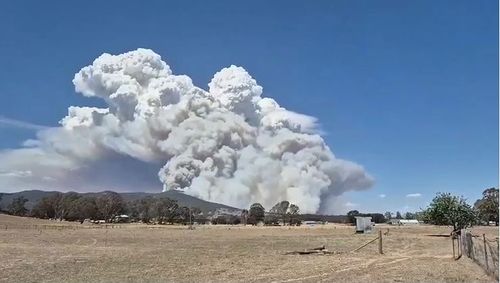
The bushfire is just 60 kilometres from a devastating fire that wiped out almost half of the town of Pomonal’s homes and businesses a week ago.
There is spotting up to 10 kilometres ahead of the main fire and it’s understood fire crews are working to save properties and farmhouses about two kilometres from the fire.
The fire is about 15 kilometres from the township of Beaufort, and around 10 kilometres away from the Western Highway.
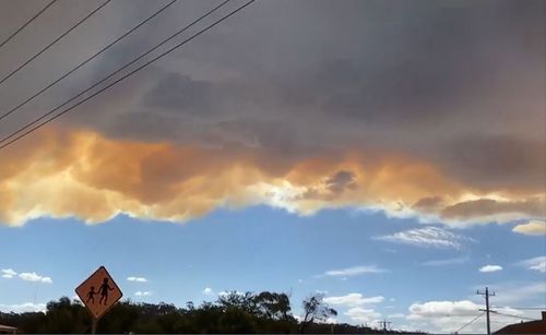
Large plumes of smoke have filled the air in local areas.
It comes as temperatures in Melbourne are forecast to hit 38 degrees while the rest of the state will reach into the early 40s.
Students in the 31 Victorian local government areas facing extreme fire danger on Thursday have been temporarily relocated, including pupils from multiple schools in Melbourne’s north-east.
The severe weather has heightened the risk of bushfires and authorities have warned weakened infrastructure from last week’s storms could become dislodged.
Bureau of Meteorology senior meteorologist Christie Johnson said today’s conditions were more dangerous for fires, but added strong winds could cause serious damage.
“Last week’s system was very unusual in that it had catastrophic fire danger but also enough moisture in the air to provide a lot of energy to the thunderstorms,” Johnson said.
” That said, there still is very extreme fire dangers, so if we do see fires develop they could be very difficult to contain…it could still be a very dangerous day.
“If there were any trees or infrastructure that were weakened last week, we could still see winds bringing down some branches, perhaps putting debris across the road, perhaps impacting some powerlines.”
Today’s heat combined with the fierce winds are forecast to bring extreme fire danger to parts of south-western south-eastern regions.
In an update early today, the Bureau of Meteorology issued an extreme fire danger warning for the Mallee, Wimmera, Northern Country, North Central, South West and Central fire districts.
“Thunderstorms will develop about central and eastern parts of the state during the day and may exacerbate the dangerous fire weather,” the bureau said.
There is a total fire ban in place for Mallee, Wimmera South West, Northern Country, North Central and Central districts.

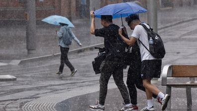
Severe thunderstorm causes commuter chaos across Sydney
Deputy chief officer of the CFA Rohan Luke said it would be a difficult day for firefighters, who are still battling blazes in Victoria’s west.
“While we’re not expecting to see the same conditions as last week, we are expecting to see a challenging day,” he said.
“The temperatures are increasing and it will be a dynamic situation, so we’re asking people to be vigilant.”
The hot weather comes as around 1200 AusNet customers remain without power, which is expected to come back online today.
The increased heat and humidity will also bring an increased risk of thunderstorms over parts of Victoria and New South Wales today, which may be severe in the Hunter and Mid North Coast districts in NSW.
These storms could produce heavy rainfall, damaging winds and large hail.
Relief is expected by late afternoon in Victoria when a cooler south-westerly change sweeps in.


