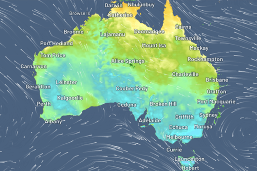
Residents in some parts of Western Australia have shivered through the coldest May morning morning in two decades, smashing a 24-year record.
Both today and on Sunday, Broome locals woke to a frosty 11.5 degrees, marking the chilliest pre-winter morning since this time in 1999.
Meteorologists say that Aussies living in the country’s north may also need to layer up in the coming days, as the icy air gripping much of the nation gradually climbs its way upward.

“A persistent ridge of high pressure has brought settled weather across large parts of the Kimberley in northern WA, as well as parts of the NT,” Weatherzone said.
“In addition, clear skies and calm-to-light southeasterly winds have allowed overnight temperatures to plummet in recent days.”
Though not quite as chilly as in Broome, Darwin recorded a minimum temperature of 17.5 degrees last Thursday, the lowest for this time in May in eight years.
It’s not just the west experiencing cooler-than-average conditions, the east coast has also been lashed by a cold snap, which is set to continue in some parts this week.
Along the eastern seaboard, a number of weather warnings have been issued by the Bureau of Meteorology.
Residents in Victoria and New South Wales are set for a frosty start to the week, with conditions on Monday and Tuesday in particular set to be cold and windy.
Read Related Also: Iowa cuts off payments for sexual assault victims’ emergency contraception, abortions
Sheep graziers in both states have been warned to monitor livestock, with “cold temperatures and northerly winds expected” in Victoria and “cold temperatures, showers and westerly winds” set to lash NSW.
Meanwhile, every eastern jurisdiction from Queensland down to Victoria – including the ACT – has been issued a severe wind warning by The Bureau.
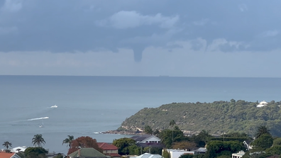
Big waterspout spotted off iconic Sydney beach
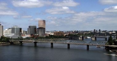
Across the nation’s metropolitan areas, Sydney will see tops of 19 degrees today with a low of 11 degrees, Melbourne will reach 22 degrees today with sunny skies and a low of 11.
In Brisbane, scattered showers are expected though it’ll be a pleasant 23 degrees, in Canberra, tops of 18 degrees are forecast with the low plummeting to 1 degree.
It’ll be 20 and fine in Adelaide, with a low of nine degrees, while in Perth, forecasters expect a top of 21 degrees today.
Sign up here to receive our daily newsletters and breaking news alerts, sent straight to your inbox.