
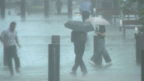
Australia’s east coast is in for a thorough soaking from today that is set to last right into next week in places.
Bureau of Meteorology senior meteorologist Miriam Bradbury said scattered showers had already developed over the east coast, centred around south-east Queensland and north-east New South Wales.
Falls of 20mm to 25mm have been recorded, rising to up to 40mm in the above-mentioned regions.
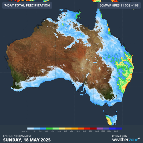
The heaviest falls so far have been on the Sunshine Coast and offshore Queensland islands, which received 50mm to 70mm of rain.
Today, Bradbury said, the rain would become more widespread across central and southern Queensland as well as eastern and north-east NSW, driven by a low-pressure trough in the upper atmosphere and moist winds coming off the ocean.
Thunderstorms are expected in affected areas in Queensland as well as northern NSW, but not severe ones.
The rain will continue through the weekend along eastern Australia, beginning to clear in Queensland on Sunday.
But it is set to continue in NSW through to early next week, with rainfall totals of 50mm to 100mm expected to accumulate.
Unfortunately, beyond moderate scattered showers, the deluge won’t affect drought-stricken areas in Victoria or South Australia.
Bradbury said southern Australia would be hit by a cold burst on Friday and Saturday, dropping the temperature up to 10 degrees.
Snow may fall at 500m in Tasmania and 1000m in Victoria on Friday, but only in small amounts as a mass of dry air will soon follow.