
Winter is well and truly on its way after millions of Australians were greeted with an unusually icy weekend.
A cold front swept across south-east Australia over the past two days, resulting in snow falling in parts of Tasmania and light frost and ice dusting front lawns around Victoria and the Australian Capital Territory.
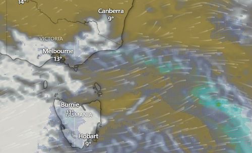
Melbournians shivered through the city’s coldest night so far in 2025 as temperatures plummeted to 7.4 degrees yesterday morning, Weatherzone reports.
Meanwhile, those in Canberra enjoyed a frosty April morning after the temperature dipped to -0.1 degrees yesterday, too.
It was even colder in Falls Creek in the Victorian Alps at -0.4 degrees and Mt Hotham saw slightly lower temperatures reaching -0.6 degrees.
Off the mainland in Tasmania, temperatures were particularly wintry.
Mt Wellington reached a low of -2.7 degrees on Saturday morning and snow was even reported on the mountain over the weekend.
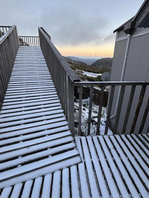
Weatherzone reports a weather station in western Tasmania saw snowfall of 30mm or more on Saturday and yesterday evening.
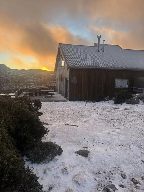
Ben Lomond, Tasmania’s only commercial ski field, was lightly dusted with some unexpected snowfall on Sunday morning.
It wasn’t quite enough to ski but could be a sign of things to come for the snow season.
Despite the cooler temperatures around Victoria and the ACT, New South Wales managed to avoid the icier weather thanks to some warmer westerly winds.
The cool autumn weather won’t be sticking around too much, according to the Bureau of Meteorology.
The BoM forecasts there will be a smattering of abnormally warm days from April to June this year.
“Warmer than average days are very likely across most of the of Australia and cooler than average days are likely for parts of the north,” the BoM said in its four-month climate outlook.